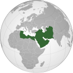
ဖိုင်:Abbasids850.png
ပုံပန်းသွင်ပြင်

ဤနမူနာ၏ အရွယ်အစား - ၈၀၀ × ၄၈၇ ပစ်ဇယ်။ အခြား ပုံရိပ်ပြတ်သားမှု: ၃၂၀ × ၁၉၅ ပစ်ဇယ် | ၆၄၀ × ၃၉၀ ပစ်ဇယ် | ၁၀၂၄ × ၆၂၄ ပစ်ဇယ် | ၁၄၈၁ × ၉၀၂ ပစ်ဇယ်။
မူရင်းဖိုင် (၁၄၈၁ × ၉၀၂ pixels, ဖိုင်အရွယ်အစား - ၅၀ KB, MIME အမျိုးအစား image/png)
ဖိုင်မှတ်တမ်း
ဖိုင်ကို ယင်းနေ့စွဲ အတိုင်း မြင်နိုင်ရန် နေ့စွဲ/အချိန် တစ်ခုခုပေါ်တွင် ကလစ်နှိပ်ပါ။
| နေ့စွဲ/အချိန် | နမူနာပုံငယ် | မှတ်တမ်း ဒိုင်မန်းရှင်းများ | အသုံးပြုသူ | မှတ်ချက် | |
|---|---|---|---|---|---|
| ကာလပေါ် | ၁၀:၄၂၊ ၂၅ မတ် ၂၀၁၂ |  | ၁၄၈၁ × ၉၀၂ (၅၀ KB) | Cplakidas | corrections: the eastern half of Sicily was still in Byz. hands, as was Malta. Sardinia and Corsica were raided but never conquered |
| ၁၅:၂၈၊ ၂၂ ဧပြီ ၂၀၀၉ |  | ၁၄၈၁ × ၉၀၂ (၅၀ KB) | Gabagool | some corrections.. | |
| ၁၆:၂၈၊ ၂၁ ဧပြီ ၂၀၀၉ |  | ၁၄၈၁ × ၉၀၂ (၅၀ KB) | Gabagool | {{Information |Description={{en|1=Map of the Abbasid Caliphat at its greatest extent, c. 850. (Partially based on ''Atlas of World History'' (2007) - Progress of Islam, map)}} |Source=Own work by uploader |Author=Gabagool / Jarle Grøhn |
ဖိုင်သုံးစွဲမှု
အောက်ပါ စာမျက်နှာ သည် ဤဖိုင်ကို အသုံးပြုထားသည်:
ဂလိုဘယ် ဖိုင်သုံးစွဲမှု
အောက်ပါ အခြားဝီကီများတွင် ဤဖိုင်ကို အသုံးပြုထားသည်-
- af.wikipedia.org တွင် အသုံးပြုမှု
- als.wikipedia.org တွင် အသုံးပြုမှု
- an.wikipedia.org တွင် အသုံးပြုမှု
- ar.wikipedia.org တွင် အသုံးပြုမှု
- arz.wikipedia.org တွင် အသုံးပြုမှု
- ast.wikipedia.org တွင် အသုံးပြုမှု
- azb.wikipedia.org တွင် အသုံးပြုမှု
- bat-smg.wikipedia.org တွင် အသုံးပြုမှု
- be-tarask.wikipedia.org တွင် အသုံးပြုမှု
- be.wikipedia.org တွင် အသုံးပြုမှု
- bg.wikipedia.org တွင် အသုံးပြုမှု
- bn.wikipedia.org တွင် အသုံးပြုမှု
- br.wikipedia.org တွင် အသုံးပြုမှု
- bs.wikipedia.org တွင် အသုံးပြုမှု
- bxr.wikipedia.org တွင် အသုံးပြုမှု
- ca.wikipedia.org တွင် အသုံးပြုမှု
- cbk-zam.wikipedia.org တွင် အသုံးပြုမှု
- ckb.wikipedia.org တွင် အသုံးပြုမှု
- cs.wikipedia.org တွင် အသုံးပြုမှု
- da.wikipedia.org တွင် အသုံးပြုမှု
- de.wikipedia.org တွင် အသုံးပြုမှု
- diq.wikipedia.org တွင် အသုံးပြုမှု
- en.wikipedia.org တွင် အသုံးပြုမှု
ဤဖိုင်ကို အခြားနေရာများတွင် အသုံးပြုထားမှုများအား ကြည့်ရှုရန်။


