
ဖိုင်:Cuba location map.svg

Size of this PNG preview of this SVG file: ၈၀၀ × ၃၃၉ ပစ်ဇယ်. အခြား ပုံရိပ်ပြတ်သားမှု: ၃၂၀ × ၁၃၆ ပစ်ဇယ် | ၆၄၀ × ၂၇၁ ပစ်ဇယ် | ၁၀၂၄ × ၄၃၄ ပစ်ဇယ် | ၁၂၈၀ × ၅၄၃ ပစ်ဇယ် | ၂၅၆၀ × ၁၀၈၅ ပစ်ဇယ် | ၁၇၉၅ × ၇၆၁ ပစ်ဇယ်။
မူရင်းဖိုင် (SVG ဖိုင်, ၁၇၉၅ × ၇၆၁ pixels ကို အကြံပြုသည်, ဖိုင်အရွယ်အစား - ၃၁၀ KB)
| ဤဖိုင်သည် Wikimedia Commons မှဖြစ်ပြီး အခြားပရောဂျက်များတွင် သုံးကောင်းသုံးလိမ့်မည်။ ယင်း၏ ဖိုင်အကြောင်းစာမျက်နှာ တွင် ဖော်ပြထားချက်ကို အောက်တွင် ပြထားသည်။ Commons သည် မူပိုင်ခွင့်လွတ်လပ်သော မီဒီယာဖိုင်များ သိုလှောင်ထားရာ နေရာ ဖြစ်သည်။ သင်လည်း ပါဝင်ကူညီနိုင်ပါသည်။ |
အကျဉ်းချုပ်
| ဖော်ပြချက် |
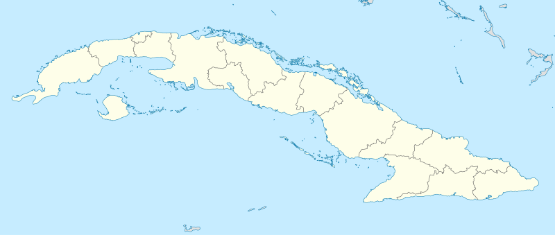
Deutsch: Positionskarte von Kuba
Quadratische Plattkarte, N-S-Streckung 105 %. Geographische Begrenzung der Karte:
English: Location map of Cuba
Equirectangular projection, N/S stretching 105 %. Geographic limits of the map:
|
||
| ရက်စွဲ | |||
| ရင်းမြစ် | ကိုယ်ပိုင်ဖန်တီးမှု, using United States National Imagery and Mapping Agency data | ||
| စာရေးသူ | NordNordWest | ||
| SVG genesis | ဤ SVG ၏ ကုဒ်သည် ခိုင်လုံသည်. This map was created with unknown tool.
|

လိုင်စင်သတ်မှတ်ခြင်း
ကျွန်ုပ်၊ ဤလုပ်ဆောင်ချက်၏ မူပိုင်ခွင့်ပိုင်ရှင်အနေဖြင့် ဤနေရာမှ အောက်ပါလိုင်စင်များအောက်တွင် ထုတ်လွှင့်ပါသည်:

|
ဤစာတမ်းကို GNU Free Documentation License, ဗားရှင်း ၁.၂ သို့မဟုတ် Free Software Foundation မှ ဖြန့်ချီထားသော မည်သည့်ယခင်ဗားရှင်းတစ်ခုခုအောက်တွင် Invariant Sections, Front-Cover Texts နှင့် Back-Cover Texts များမပါဝင်ဘဲ ကူးယူခြင်း၊ ဖြန့်ချီခြင်း နှင့်/သို့မဟုတ် ပြင်ဆင်ပြောင်းလဲနိုင်ရန် ခွင့်ပြုသည်။ လိုင်စင်မူပွားကို GNU Free Documentation License ခေါင်းစဉ်အောက်တွင် ထည့်သွင်းထားသည်။ |
ဤဖိုင်ကို Creative Commons Attribution-Share Alike 3.0 Unported လိုင်စင်ဖြင့် သတ်မှတ်ထားသည်။
- သင်သည် လွတ်လပ်စွာ:
- မျှဝေရန် – ဖန်တီးမှုကို ကူးယူရန်၊ ဖြန့်ဖြူးရန်နှင့် ထုတ်လွှင့်ရန်
- ပြန်ရောနှောရန် – ဖန်တီးမှုကို ပြင်ဆင်ညှိနှိုင်းရန်
- အောက်ပါ အခြေအနေများတွင်:
- မှတ်ယူနိုင်ခြင်း – ပြောင်းလဲမှုများ ပြုလုပ်ခဲ့ပါက ဖန်တီးသူ သို့မဟုတ် လိုင်စင်ရှိသူမှ သတ်မှတ်သော အမျိုးအစားကို လိုက်နာရမည် (ဆိုလိုသည်မှာ သင့်အား သို့မဟုတ် သင့်ဖန်တီးမှုတွင် အသုံးပြုခြင်းအား ထောက်ခံချက်ပေးသည်ဟု မဆိုလိုပါ)။
- ထပ်တူမျှဝေ – ဤဖန်တီးမှုအား ပြင်ဆင်ခြင်း၊ ပြောင်းလဲခြင်း သို့မဟုတ် ထပ်ဆင့် ဖန်တီးခြင်း ပြုလုပ်ပါက ရရှိလာသော ဖန်တီးမှုကို ဤဖန်တီးမှုနှင့် သို့မဟုတ် ဆင်တူသော လိုင်စင်ဖြင့်သာ ဖြန့်ချိသင့်သည်။
သင်အလိုရှိရာ လိုင်စင်ကို ရွေးချယ်နိုင်ပါသည်။
ဖိုင်မှတ်တမ်း
ဖိုင်ကို ယင်းနေ့စွဲ အတိုင်း မြင်နိုင်ရန် နေ့စွဲ/အချိန် တစ်ခုခုပေါ်တွင် ကလစ်နှိပ်ပါ။
| နေ့စွဲ/အချိန် | နမူနာပုံငယ် | မှတ်တမ်း ဒိုင်မန်းရှင်းများ | အသုံးပြုသူ | မှတ်ချက် | |
|---|---|---|---|---|---|
| ကာလပေါ် | ၁၁:၄၇၊ ၃၁ ဒီဇင်ဘာ ၂၀၁၀ | | ၁၇၉၅ × ၇၆၁ (၃၁၀ KB) | NordNordWest | upd |
| ၁၉:၃၃၊ ၄ စက်တင်ဘာ ၂၀၀၈ |  | ၁၇၉၆ × ၇၆၁ (၄၅၈ KB) | NordNordWest | minor corrections at contents and graphics | |
| ၂၀:၃၇၊ ၃ စက်တင်ဘာ ၂၀၀၈ |  | ၁၇၉၆ × ၇၆၁ (၄၆၁ KB) | NordNordWest | {{Information |Description= {{de|Positionskarte von Kuba}} Quadratische Plattkarte, N-S-Streckung 105 %. Geographische Begrenzung der Karte: * N: 23.8° N * S: 19.2° N * W: 85.2° W * O: 73.8° W {{en|Location map of Cuba}} Equi |
ဖိုင်သုံးစွဲမှု
အောက်ပါ 2 စာမျက်နှာများ သည် ဤဖိုင်ကို အသုံးပြုထားသည်:
ဂလိုဘယ် ဖိုင်သုံးစွဲမှု
အောက်ပါ အခြားဝီကီများတွင် ဤဖိုင်ကို အသုံးပြုထားသည်-
- af.wikipedia.org တွင် အသုံးပြုမှု
- an.wikipedia.org တွင် အသုံးပြုမှု
- ar.wikipedia.org တွင် အသုံးပြုမှု
- ast.wikipedia.org တွင် အသုံးပြုမှု
- L'Habana
- Estadiu Calixto García Íñiguez
- Santiago de Cuba
- Capitoliu de L'Habana
- Palaciu de la Revolución
- Plaza de la Revolución
- Módulu:Mapa de llocalización/datos/Cuba
- Aeropuertu Baracoa
- Aeropuertu Gustavo Rizo
- Aeropuertu Hermanos Ameijeiras
- Aeropuertu Juan Gualberto Gómez
- Aeropuertu Rafael Cabrera
- Aeropuertu de Cayo Coco
- Boca de Camarioca
- Matanzas
- Módulu:Mapa de llocalización/datos/Cuba/usu
- Santa Clara (Cuba)
- az.wikipedia.org တွင် အသုံးပြုမှု
- ban.wikipedia.org တွင် အသုံးပြုမှု
- ba.wikipedia.org တွင် အသုံးပြုမှု
- be-tarask.wikipedia.org တွင် အသုံးပြုမှု
ဤဖိုင်ကို အခြားနေရာများတွင် အသုံးပြုထားမှုများအား ကြည့်ရှုရန်။