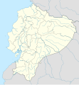
ဖိုင်:Ecuador location map.svg
ပုံပန်းသွင်ပြင်

Size of this PNG preview of this SVG file: ၅၅၆ × ၅၉၉ ပစ်ဇယ်. အခြား ပုံရိပ်ပြတ်သားမှု: ၂၂၃ × ၂၄၀ ပစ်ဇယ် | ၄၄၅ × ၄၈၀ ပစ်ဇယ် | ၇၁၃ × ၇၆၈ ပစ်ဇယ် | ၉၅၀ × ၁၀၂၄ ပစ်ဇယ် | ၁၉၀၁ × ၂၀၄၈ ပစ်ဇယ် | ၁၅၃၅ × ၁၆၅၄ ပစ်ဇယ်။
မူရင်းဖိုင် (SVG ဖိုင်, ၁၅၃၅ × ၁၆၅၄ pixels ကို အကြံပြုသည်, ဖိုင်အရွယ်အစား - ၁.၀၃ MB)
ဖိုင်မှတ်တမ်း
ဖိုင်ကို ယင်းနေ့စွဲ အတိုင်း မြင်နိုင်ရန် နေ့စွဲ/အချိန် တစ်ခုခုပေါ်တွင် ကလစ်နှိပ်ပါ။
| နေ့စွဲ/အချိန် | နမူနာပုံငယ် | မှတ်တမ်း ဒိုင်မန်းရှင်းများ | အသုံးပြုသူ | မှတ်ချက် | |
|---|---|---|---|---|---|
| ကာလပေါ် | ၂၃:၅၇၊ ၂ ဇွန် ၂၀၂၃ |  | ၁၅၃၅ × ၁၆၅၄ (၁.၀၃ MB) | Milenioscuro | code clean |
| ၂၃:၅၉၊ ၁၈ ဧပြီ ၂၀၂၃ |  | ၁၅၃၅ × ၁၆၅၄ (၁.၉၁ MB) | David C. S. | Límites | |
| ၂၃:၅၅၊ ၁၈ ဧပြီ ၂၀၂၃ |  | ၁၅၃၅ × ၁၆၅၄ (၁.၉၁ MB) | David C. S. | Límites y ríos | |
| ၀၃:၃၀၊ ၃ ဧပြီ ၂၀၂၃ |  | ၁၅၃၅ × ၁၆၅၄ (၁.၈၆ MB) | David C. S. | Límites | |
| ၂၃:၄၀၊ ၃၀ မတ် ၂၀၂၃ |  | ၁၅၃၅ × ၁၆၅၄ (၁.၇၉ MB) | David C. S. | Límites y ríos | |
| ၂၃:၂၀၊ ၂၄ မတ် ၂၀၂၃ |  | ၁၅၃၅ × ၁၆၅၄ (၁.၅ MB) | David C. S. | Límites y ríos | |
| ၁၆:၂၈၊ ၁၃ ဖေဖော်ဝါရီ ၂၀၂၃ |  | ၁၅၃၅ × ၁၆၅၄ (၁.၃၇ MB) | David C. S. | Límites y ríos | |
| ၂၁:၀၃၊ ၁ မေ ၂၀၁၈ |  | ၁၅၃၅ × ၁၆၅၄ (၂၄၆ KB) | Janitoalevic | Added Payana island to Ecuador color. | |
| ၁၈:၄၈၊ ၂၀ ဇွန် ၂၀၁၂ |  | ၁၅၃၅ × ၁၆၅၄ (၂၄၂ KB) | NordNordWest | upd | |
| ၁၆:၂၈၊ ၁၄ ဇွန် ၂၀၁၂ |  | ၁၅၃၅ × ၁၆၅၄ (၂၃၁ KB) | NordNordWest | Reverted to version as of 10:28, 14 June 2012. See your talk page. Please do not change this map again. |
ဖိုင်သုံးစွဲမှု
အောက်ပါ 2 စာမျက်နှာများ သည် ဤဖိုင်ကို အသုံးပြုထားသည်:
ဂလိုဘယ် ဖိုင်သုံးစွဲမှု
အောက်ပါ အခြားဝီကီများတွင် ဤဖိုင်ကို အသုံးပြုထားသည်-
- af.wikipedia.org တွင် အသုံးပြုမှု
- an.wikipedia.org တွင် အသုံးပြုမှု
- ar.wikipedia.org တွင် အသုံးပြုမှု
- ast.wikipedia.org တွင် အသုံးပြုမှု
- Quitu
- Volcán Chimborazo
- Palaciu Llexislativu d'Ecuador
- Volcán Cotopaxi
- Módulu:Mapa de llocalización/datos/Ecuador
- Campeonatu Suramericanu 1947
- Copa América 1993
- Universidá Central del Ecuador
- Aeropuertu Chachoan - Ambato
- Aeropuertu Francisco de Orellana
- Aeropuertu General Manuel Serrano - Machala
- Aeropuertu Internacional Mariscal Sucre
- Aeropuertu José María Velasco Ibarra - Macará
- Aeropuertu Jumandy
- Aeropuertu Mayor Galo de la Torre
- Aeropuertu Río Amazonas
- Aeropuertu de Lago Agrio
- Antiguu Aeropuertu Internacional Mariscal Sucre
- Puertu de Manta
- Módulu:Mapa de llocalización/datos/Ecuador/usu
- Golfu de Guayaquil
- az.wikipedia.org တွင် အသုံးပြုမှု
- ban.wikipedia.org တွင် အသုံးပြုမှု
- be-tarask.wikipedia.org တွင် အသုံးပြုမှု
- be.wikipedia.org တွင် အသုံးပြုမှု
ဤဖိုင်ကို အခြားနေရာများတွင် အသုံးပြုထားမှုများအား ကြည့်ရှုရန်။


