
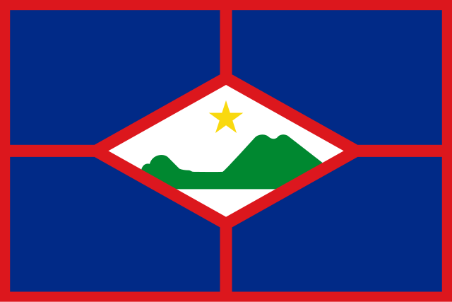
ဖိုင်:Flag of Sint Eustatius.svg

Size of this PNG preview of this SVG file: ၈၀၀ × ၅၃၃ ပစ်ဇယ်. အခြား ပုံရိပ်ပြတ်သားမှု: ၃၂၀ × ၂၁၃ ပစ်ဇယ် | ၆၄၀ × ၄၂၇ ပစ်ဇယ် | ၁၀၂၄ × ၆၈၃ ပစ်ဇယ် | ၁၂၈၀ × ၈၅၃ ပစ်ဇယ် | ၂၅၆၀ × ၁၇၀၇ ပစ်ဇယ်။
မူရင်းဖိုင် (SVG ဖိုင်, ၉၀၀ × ၆၀၀ pixels ကို အကြံပြုသည်, ဖိုင်အရွယ်အစား - ၁ KB)
| ဤဖိုင်သည် Wikimedia Commons မှဖြစ်ပြီး အခြားပရောဂျက်များတွင် သုံးကောင်းသုံးလိမ့်မည်။ ယင်း၏ ဖိုင်အကြောင်းစာမျက်နှာ တွင် ဖော်ပြထားချက်ကို အောက်တွင် ပြထားသည်။ Commons သည် မူပိုင်ခွင့်လွတ်လပ်သော မီဒီယာဖိုင်များ သိုလှောင်ထားရာ နေရာ ဖြစ်သည်။ သင်လည်း ပါဝင်ကူညီနိုင်ပါသည်။ |
အကျဉ်းချုပ်
| ဖော်ပြချက် |
|
| ရက်စွဲ | |
| ရင်းမြစ် | hand-drawn using Inkscape, based on descriptions at http://www.statiagovernment.com/faq.html#fla and http://www.crwflags.com/fotw/flags/an-se.html |
| စာရေးသူ | User:Andrwsc |
လိုင်စင်သတ်မှတ်ခြင်း
ကျွန်ုပ်၊ ဤလုပ်ဆောင်ချက်၏ မူပိုင်ခွင့်ပိုင်ရှင်အနေဖြင့် ဤနေရာမှ အောက်ပါလိုင်စင်များအောက်တွင် ထုတ်လွှင့်ပါသည်:

|
ဤစာတမ်းကို GNU Free Documentation License, ဗားရှင်း ၁.၂ သို့မဟုတ် Free Software Foundation မှ ဖြန့်ချီထားသော မည်သည့်ယခင်ဗားရှင်းတစ်ခုခုအောက်တွင် Invariant Sections, Front-Cover Texts နှင့် Back-Cover Texts များမပါဝင်ဘဲ ကူးယူခြင်း၊ ဖြန့်ချီခြင်း နှင့်/သို့မဟုတ် ပြင်ဆင်ပြောင်းလဲနိုင်ရန် ခွင့်ပြုသည်။ လိုင်စင်မူပွားကို GNU Free Documentation License ခေါင်းစဉ်အောက်တွင် ထည့်သွင်းထားသည်။ |
This file is licensed under the Creative Commons Attribution-Share Alike 4.0 International, 3.0 Unported, 2.5 Generic, 2.0 Generic and 1.0 Generic license.
- သင်သည် လွတ်လပ်စွာ:
- မျှဝေရန် – ဖန်တီးမှုကို ကူးယူရန်၊ ဖြန့်ဖြူးရန်နှင့် ထုတ်လွှင့်ရန်
- ပြန်ရောနှောရန် – ဖန်တီးမှုကို ပြင်ဆင်ညှိနှိုင်းရန်
- အောက်ပါ အခြေအနေများတွင်:
- မှတ်ယူနိုင်ခြင်း – ပြောင်းလဲမှုများ ပြုလုပ်ခဲ့ပါက ဖန်တီးသူ သို့မဟုတ် လိုင်စင်ရှိသူမှ သတ်မှတ်သော အမျိုးအစားကို လိုက်နာရမည် (ဆိုလိုသည်မှာ သင့်အား သို့မဟုတ် သင့်ဖန်တီးမှုတွင် အသုံးပြုခြင်းအား ထောက်ခံချက်ပေးသည်ဟု မဆိုလိုပါ)။
- ထပ်တူမျှဝေ – ဤဖန်တီးမှုအား ပြင်ဆင်ခြင်း၊ ပြောင်းလဲခြင်း သို့မဟုတ် ထပ်ဆင့် ဖန်တီးခြင်း ပြုလုပ်ပါက ရရှိလာသော ဖန်တီးမှုကို ဤဖန်တီးမှုနှင့် သို့မဟုတ် ဆင်တူသော လိုင်စင်ဖြင့်သာ ဖြန့်ချိသင့်သည်။
သင်အလိုရှိရာ လိုင်စင်ကို ရွေးချယ်နိုင်ပါသည်။
ဖိုင်မှတ်တမ်း
ဖိုင်ကို ယင်းနေ့စွဲ အတိုင်း မြင်နိုင်ရန် နေ့စွဲ/အချိန် တစ်ခုခုပေါ်တွင် ကလစ်နှိပ်ပါ။
| နေ့စွဲ/အချိန် | နမူနာပုံငယ် | မှတ်တမ်း ဒိုင်မန်းရှင်းများ | အသုံးပြုသူ | မှတ်ချက် | |
|---|---|---|---|---|---|
| ကာလပေါ် | ၁၈:၅၃၊ ၂၅ ဇန်နဝါရီ ၂၀၁၃ | | ၉၀၀ × ၆၀၀ (၁ KB) | SiBr4 | Seams |
| ၁၈:၂၈၊ ၁၄ ဇူလိုင် ၂၀၁၀ |  | ၉၀၀ × ၆၀၀ (၂ KB) | Andrwsc | not necessary to add bloated SVG markup just to change the colours... | |
| ၀၅:၀၅၊ ၁၁ ဇူလိုင် ၂၀၁၀ |  | ၉၀၀ × ၆၀၀ (၄ KB) | Fry1989 | colours | |
| ၂၀:၅၈၊ ၁၉ ဇန်နဝါရီ ၂၀၁၀ |  | ၉၀၀ × ၆၀၀ (၂ KB) | Andrwsc | {{Information |Description={{en|1=Flag of en:Sint Eustatius}} |Source=hand-drawn using Inkscape, based on descriptions at http://www.statiagovernment.com/faq.html#fla and http://www.crwflags.com/fotw/flags/an-se.html |Author=User:Andrwsc |Date=20 |
ဖိုင်သုံးစွဲမှု
အောက်ပါ 6 စာမျက်နှာများ သည် ဤဖိုင်ကို အသုံးပြုထားသည်:
- မြောက်အမေရိကတိုက်ရှိ အချုပ်အခြာအာဏာပိုင်နိုင်ငံများနှင့် အမှီအခိုနယ်မြေများ စာရင်း
- လူဦးရေ သိပ်သည်းမှုအလိုက် နိုင်ငံနှင့် နယ်မြေဒေသများ စာရင်း
- လူဦးရေအလိုက် နိုင်ငံနှင့် နယ်မြေဒေသများ စာရင်း
- ဧရိယာအလိုက် နိုင်ငံနှင့် နယ်မြေဒေသများ စာရင်း
- ၂၀၁၉-၂၀ ကိုရိုနာဗိုင်းရပ်စ် ဖြစ်ပွားမှု
- တမ်းပလိတ်:2019–20 coronavirus pandemic data
ဂလိုဘယ် ဖိုင်သုံးစွဲမှု
အောက်ပါ အခြားဝီကီများတွင် ဤဖိုင်ကို အသုံးပြုထားသည်-
- af.wikipedia.org တွင် အသုံးပြုမှု
- Noord-Amerika
- Atlantiese Oseaan
- Lys van hoofstede
- Nederlandse Antille
- Vlae van provinsies van Nederland
- Sjabloon:Landdata Nederland
- Lys van lande
- Sjabloon:Landdata Nederlands-Antille
- Lys van afhanklike gebiede
- Vlae van Noord-Amerika
- Sint Eustatius
- Kategorie:Sint Eustatius
- Oranjestad (Sint Eustatius)
- Karibiese Nederland
- Klein-Antille
- Wes-Indië
- Vlag van Sint Eustatius
- Antille
- Karibiese gebied
- Wes-Indiese nasionale krieketspan
- Sjabloon:Landdata Bonaire
- Sjabloon:Landdata Saba
- Sjabloon:Landdata Sint Eustatius
- Sjabloon:Landdata Koninkryk van die Nederlande
- Sjabloon:Landdata Karibiese Nederland
- Vlae van Europa
- als.wikipedia.org တွင် အသုံးပြုမှု
- an.wikipedia.org တွင် အသုံးပြုမှု
- ar.wikipedia.org တွင် အသုံးပြုမှု
- هولندا
- قائمة الدول والتبعيات حسب المساحة
- أمريكا الشمالية
- الكاريبي
- جزر الأنتيل الصغرى
- الأمريكتان
- ملحقات (سياسة)
- قائمة البلدان والتبعيات حسب الكثافة السكانية
- قائمة العملات المتداولة
- علم جزر الأنتيل الهولندية
- أعلام دول أمريكا الشمالية
- وزارة العدل
- قالب:بيانات بلد سينت أوستاتيوس
- قائمة الدول حسب التقسيمات الإدارية
- علم سانت أوستايوس
- سينت أوستاتيوس
- قالب:سينت أوستاتيوس
- جزر المملكة الهولندية الكاريبية
- مقاطعات هولندا
- قالب:بيانات بلد الجزر الكاريبية الهولندية
ဤဖိုင်ကို အခြားနေရာများတွင် အသုံးပြုထားမှုများအား ကြည့်ရှုရန်။