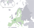
ဖိုင်:Location Luxembourg EU Europe.png
ပုံပန်းသွင်ပြင်

ဤနမူနာ၏ အရွယ်အစား - ၇၂၁ × ၆၀၀ ပစ်ဇယ်။ အခြား ပုံရိပ်ပြတ်သားမှု: ၂၈၉ × ၂၄၀ ပစ်ဇယ် | ၅၇၇ × ၄၈၀ ပစ်ဇယ် | ၉၂၃ × ၇၆၈ ပစ်ဇယ် | ၁၂၃၁ × ၁၀၂၄ ပစ်ဇယ် | ၂၀၅၆ × ၁၇၁၀ ပစ်ဇယ်။
မူရင်းဖိုင် (၂၀၅၆ × ၁၇၁၀ pixels, ဖိုင်အရွယ်အစား - ၁၄၅ KB, MIME အမျိုးအစား image/png)
ဖိုင်မှတ်တမ်း
ဖိုင်ကို ယင်းနေ့စွဲ အတိုင်း မြင်နိုင်ရန် နေ့စွဲ/အချိန် တစ်ခုခုပေါ်တွင် ကလစ်နှိပ်ပါ။
| နေ့စွဲ/အချိန် | နမူနာပုံငယ် | မှတ်တမ်း ဒိုင်မန်းရှင်းများ | အသုံးပြုသူ | မှတ်ချက် | |
|---|---|---|---|---|---|
| ကာလပေါ် | ၂၃:၅၀၊ ၁၁ ဇူလိုင် ၂၀၂၀ |  | ၂၀၅၆ × ၁၇၁၀ (၁၄၅ KB) | De728631 | added South Sudan to World map |
| ၂၁:၅၈၊ ၁၁ ဇူလိုင် ၂၀၂၀ |  | ၂၀၅၆ × ၁၇၁၀ (၁၄၅ KB) | De728631 | Brexit update | |
| ၀၁:၁၁၊ ၁၈ ဇွန် ၂၀၀၇ |  | ၂၀၅၆ × ၁၇၁၀ (၁၇၇ KB) | Quizimodo~commonswiki | image (updated) | |
| ၀၉:၄၆၊ ၁၇ ဇွန် ၂၀၀၇ |  | ၂၀၅၆ × ၁၇၁၀ (၂၂၈ KB) | Quizimodo~commonswiki | image (tweaked) | |
| ၀၈:၂၈၊ ၁၇ ဇွန် ၂၀၀၇ |  | ၂၀၅၆ × ၁၇၁၀ (၂၂၉ KB) | Quizimodo~commonswiki | {{Information |Description=Location map: Luxembourg (dark green) / European Union (light green) / Europe (dark grey); inspired by and consistent with general country locator maps by User:Vardion, et al |Source=self-made |Date=17 June 2007 |Author= [[User: |
ဖိုင်သုံးစွဲမှု
ဤဖိုင်ကို အသုံးပြုထားသော စာမျက်နှာများမရှိပါ။
ဂလိုဘယ် ဖိုင်သုံးစွဲမှု
အောက်ပါ အခြားဝီကီများတွင် ဤဖိုင်ကို အသုံးပြုထားသည်-
- gag.wikipedia.org တွင် အသုံးပြုမှု


