ဖိုင်:Natural gas NL.png
ပုံပန်းသွင်ပြင်

ဤနမူနာ၏ အရွယ်အစား - ၆၃၉ × ၅၉၉ ပစ်ဇယ်။ အခြား ပုံရိပ်ပြတ်သားမှု: ၂၅၆ × ၂၄၀ ပစ်ဇယ် | ၅၁၂ × ၄၈၀ ပစ်ဇယ် | ၈၁၉ × ၇၆၈ ပစ်ဇယ် | ၁၁၀၀ × ၁၀၃၂ ပစ်ဇယ်။
မူရင်းဖိုင် (၁၁၀၀ × ၁၀၃၂ pixels, ဖိုင်အရွယ်အစား - ၁.၂၈ MB, MIME အမျိုးအစား image/png)
ဖိုင်မှတ်တမ်း
ဖိုင်ကို ယင်းနေ့စွဲ အတိုင်း မြင်နိုင်ရန် နေ့စွဲ/အချိန် တစ်ခုခုပေါ်တွင် ကလစ်နှိပ်ပါ။
| နေ့စွဲ/အချိန် | နမူနာပုံငယ် | မှတ်တမ်း ဒိုင်မန်းရှင်းများ | အသုံးပြုသူ | မှတ်ချက် | |
|---|---|---|---|---|---|
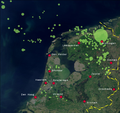
| ကာလပေါ် | ၁၅:၃၁၊ ၂၁ ဇွန် ၂၀၀၈ |  | ၁၁၀၀ × ၁၀၃၂ (၁.၂၈ MB) | Classical geographer | {{Information |Description=Map of Natural Gas concessions of the NAM in the Netherlands. Source of concessions is Shell/NAM, at http://www-static.shell.com/static/nam-nl/images/concessiekaart.gif. |Source=*[[:Image:Satellite_image_of_the_Netherlands_in_Ma |
ဖိုင်သုံးစွဲမှု
အောက်ပါ စာမျက်နှာ သည် ဤဖိုင်ကို အသုံးပြုထားသည်:
ဂလိုဘယ် ဖိုင်သုံးစွဲမှု
အောက်ပါ အခြားဝီကီများတွင် ဤဖိုင်ကို အသုံးပြုထားသည်-
- az.wikipedia.org တွင် အသုံးပြုမှု
- cs.wikipedia.org တွင် အသုံးပြုမှု
- de.wikipedia.org တွင် အသုံးပြုမှု
- de.wikinews.org တွင် အသုံးပြုမှု
- el.wikipedia.org တွင် အသုံးပြုမှု
- en.wikipedia.org တွင် အသုံးပြုမှု
- fr.wikipedia.org တွင် အသုံးပြုမှု
- fy.wikipedia.org တွင် အသုံးပြုမှု
- ko.wikipedia.org တွင် အသုံးပြုမှု
- nl.wikipedia.org တွင် အသုံးပြုမှု
- nl.wikibooks.org တွင် အသုံးပြုမှု
- nl.wikinews.org တွင် အသုံးပြုမှု
- nl.wiktionary.org တွင် အသုံးပြုမှု
- ro.wikipedia.org တွင် အသုံးပြုမှု
- sv.wikipedia.org တွင် အသုံးပြုမှု
- te.wikipedia.org တွင် အသုံးပြုမှု
- th.wikipedia.org တွင် အသုံးပြုမှု
- tr.wikipedia.org တွင် အသုံးပြုမှု
- uk.wikipedia.org တွင် အသုံးပြုမှု
- uz.wikipedia.org တွင် အသုံးပြုမှု
- vi.wikipedia.org တွင် အသုံးပြုမှု

