
ဖိုင်:North Rhine-Westphalia location map 01.svg

Size of this PNG preview of this SVG file: ၅၂၇ × ၅၂၄ ပစ်ဇယ်. အခြား ပုံရိပ်ပြတ်သားမှု: ၂၄၁ × ၂၄၀ ပစ်ဇယ် | ၄၈၃ × ၄၈၀ ပစ်ဇယ် | ၇၇၂ × ၇၆၈ ပစ်ဇယ် | ၁၀၃၀ × ၁၀၂၄ ပစ်ဇယ် | ၂၀၆၀ × ၂၀၄၈ ပစ်ဇယ်။
မူရင်းဖိုင် (SVG ဖိုင်, ၅၂၇ × ၅၂၄ pixels ကို အကြံပြုသည်, ဖိုင်အရွယ်အစား - ၁.၂၂ MB)
| ဤဖိုင်သည် Wikimedia Commons မှဖြစ်ပြီး အခြားပရောဂျက်များတွင် သုံးကောင်းသုံးလိမ့်မည်။ ယင်း၏ ဖိုင်အကြောင်းစာမျက်နှာ တွင် ဖော်ပြထားချက်ကို အောက်တွင် ပြထားသည်။ Commons သည် မူပိုင်ခွင့်လွတ်လပ်သော မီဒီယာဖိုင်များ သိုလှောင်ထားရာ နေရာ ဖြစ်သည်။ သင်လည်း ပါဝင်ကူညီနိုင်ပါသည်။ |
အကျဉ်းချုပ်
| ဖော်ပြချက် |
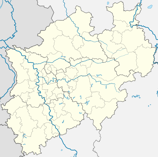
Deutsch: Positionskarte Nordrhein-Westfalen, Germany. Geographische Begrenzung der Karte:
English: Location map North Rhine-Westphalia, Germany. Geographic limits of the map:
Français : Carte du land Rhénanie-du-Nord-Westphalie (Allemagne) destinée à géolocalisation. Les limites géographiques sont:
|
|||||||||||||
| ရက်စွဲ | ||||||||||||||
| ရင်းမြစ် |
ကိုယ်ပိုင်ဖန်တီးမှု, based on (not all layers may be visible or included):
Only to compare some issues: |
|||||||||||||
| စာရေးသူ |
TUBS |
|||||||||||||
| အခြား ဗားရှင်းများ |
[]
|
|||||||||||||
| SVG genesis |


လိုင်စင်သတ်မှတ်ခြင်း
TUBS
 ၊ ဤလုပ်ဆောင်ချက်၏ မူပိုင်ခွင့်ပိုင်ရှင်အနေဖြင့် ဤနေရာမှ အောက်ပါလိုင်စင်များအောက်တွင် ထုတ်လွှင့်ပါသည်:

|
ဤစာတမ်းကို GNU Free Documentation License, ဗားရှင်း ၁.၂ သို့မဟုတ် Free Software Foundation မှ ဖြန့်ချီထားသော မည်သည့်ယခင်ဗားရှင်းတစ်ခုခုအောက်တွင် Invariant Sections, Front-Cover Texts နှင့် Back-Cover Texts များမပါဝင်ဘဲ ကူးယူခြင်း၊ ဖြန့်ချီခြင်း နှင့်/သို့မဟုတ် ပြင်ဆင်ပြောင်းလဲနိုင်ရန် ခွင့်ပြုသည်။ လိုင်စင်မူပွားကို GNU Free Documentation License ခေါင်းစဉ်အောက်တွင် ထည့်သွင်းထားသည်။ |
ဤဖိုင်သည် Creative Commons Attribution 3.0 Unported, 2.5 Generic, 2.0 Generic နှင့် 1.0 Generic လိုင်စင်အောက်တွင် လိုင်စင်သတ်မှတ်ထားပါသည်။
မှတ်ယူနိုင်ခြင်း: TUBS
- သင်သည် လွတ်လပ်စွာ:
- မျှဝေရန် – ဖန်တီးမှုကို ကူးယူရန်၊ ဖြန့်ဖြူးရန်နှင့် ထုတ်လွှင့်ရန်
- ပြန်ရောနှောရန် – ဖန်တီးမှုကို ပြင်ဆင်ညှိနှိုင်းရန်
- အောက်ပါ အခြေအနေများတွင်:
- မှတ်ယူနိုင်ခြင်း – ပြောင်းလဲမှုများ ပြုလုပ်ခဲ့ပါက ဖန်တီးသူ သို့မဟုတ် လိုင်စင်ရှိသူမှ သတ်မှတ်သော အမျိုးအစားကို လိုက်နာရမည် (ဆိုလိုသည်မှာ သင့်အား သို့မဟုတ် သင့်ဖန်တီးမှုတွင် အသုံးပြုခြင်းအား ထောက်ခံချက်ပေးသည်ဟု မဆိုလိုပါ)။
ဤဖိုင်သည် Creative Commons Attribution-Share Alike 3.0 Unported, 2.5 Generic, 2.0 Generic နှင့် 1.0 Generic လိုင်စင်အောက်တွင် လိုင်စင်သတ်မှတ်ထားပါသည်။
မှတ်ယူနိုင်ခြင်း: TUBS
- သင်သည် လွတ်လပ်စွာ:
- မျှဝေရန် – ဖန်တီးမှုကို ကူးယူရန်၊ ဖြန့်ဖြူးရန်နှင့် ထုတ်လွှင့်ရန်
- ပြန်ရောနှောရန် – ဖန်တီးမှုကို ပြင်ဆင်ညှိနှိုင်းရန်
- အောက်ပါ အခြေအနေများတွင်:
- မှတ်ယူနိုင်ခြင်း – ပြောင်းလဲမှုများ ပြုလုပ်ခဲ့ပါက ဖန်တီးသူ သို့မဟုတ် လိုင်စင်ရှိသူမှ သတ်မှတ်သော အမျိုးအစားကို လိုက်နာရမည် (ဆိုလိုသည်မှာ သင့်အား သို့မဟုတ် သင့်ဖန်တီးမှုတွင် အသုံးပြုခြင်းအား ထောက်ခံချက်ပေးသည်ဟု မဆိုလိုပါ)။
- ထပ်တူမျှဝေ – ဤဖန်တီးမှုအား ပြင်ဆင်ခြင်း၊ ပြောင်းလဲခြင်း သို့မဟုတ် ထပ်ဆင့် ဖန်တီးခြင်း ပြုလုပ်ပါက ရရှိလာသော ဖန်တီးမှုကို ဤဖန်တီးမှုနှင့် သို့မဟုတ် ဆင်တူသော လိုင်စင်ဖြင့်သာ ဖြန့်ချိသင့်သည်။
| ဤဖိုင်ကို Creative Commons CC0 1.0 Universal Public Domain Dedication အောက်တွင် ရရှိနိုင်အောင် ဆောင်ရွက်ထားပါသည်။ | |
| The person who associated a work with this deed has dedicated the work to the public domain by waiving all of their rights to the work worldwide under copyright law, including all related and neighboring rights, to the extent allowed by law. You can copy, modify, distribute and perform the work, even for commercial purposes, all without asking permission.
|
| I, the copyright holder of this work, release this work into the public domain. This applies worldwide. In some countries this may not be legally possible; if so: အကျွန်ုပ်သည် ဤဖန်တီးမှုလက်ရာကို ဥပဒေအရလိုအပ်ခြင်းမရှိသည့် မည်သည့်အခြေအနေမျိုးတွက်မဆို၊ မည်သို့သော ရည်ရွယ်ချက်အတွက်မဆို ၎င်းကို မည်သူမဆို အသုံးပြုပိုင်ခွင့်အား ပေးအပ်သည်။ |
| Copyleft: This work of art is free; you can redistribute it and/or modify it according to terms of the Free Art License. You will find a specimen of this license on the Copyleft Attitude site as well as on other sites. |

|
ဤဖိုင်၏ မူပိုင်ခွင့်ကိုင်ဆောင်သူ TUBS |
|
|
သင်အလိုရှိရာ လိုင်စင်ကို ရွေးချယ်နိုင်ပါသည်။

|
I'd greatly appreciate, that you attribute this media file to Wikimedia Commons, if used outside Wikipedia or Commons. For use in publications such as books, newspapers, blogs, websites, please insert here the following line:
|
ဖိုင်မှတ်တမ်း
ဖိုင်ကို ယင်းနေ့စွဲ အတိုင်း မြင်နိုင်ရန် နေ့စွဲ/အချိန် တစ်ခုခုပေါ်တွင် ကလစ်နှိပ်ပါ။
| နေ့စွဲ/အချိန် | နမူနာပုံငယ် | မှတ်တမ်း ဒိုင်မန်းရှင်းများ | အသုံးပြုသူ | မှတ်ချက် | |
|---|---|---|---|---|---|
| ကာလပေါ် | ၁၉:၃၅၊ ၁၆ ဒီဇင်ဘာ ၂၀၀၉ | | ၅၂၇ × ၅၂၄ (၁.၂၂ MB) | TUBS | korr crop area |
| ၀၉:၀၅၊ ၂၀ အောက်တိုဘာ ၂၀၀၉ |  | ၆၅၇ × ၆၅၆ (၄၇၆ KB) | TUBS | -ac | |
| ၂၀:၃၃၊ ၂၆ ဇန်နဝါရီ ၂၀၀၉ |  | ၆၅၇ × ၆၅၆ (၄၇၉ KB) | TUBS | {{Information |Description= |Source= |Date= |Author= |Permission= |other_versions= }} | |
| ၂၀:၂၆၊ ၂၆ ဇန်နဝါရီ ၂၀၀၉ |  | ၆၅၇ × ၆၅၆ (၄၇၉ KB) | TUBS | {{Information |Description= |Source= |Date= |Author= |Permission= |other_versions= }} | |
| ၀၈:၂၃၊ ၄ နိုဝင်ဘာ ၂၀၀၈ |  | ၆၅၇ × ၆၅၆ (၄၂၉ KB) | TUBS | {{Information |Description= |Source= |Date= |Author= |Permission= |other_versions= }} | |
| ၀၈:၄၀၊ ၉ အောက်တိုဘာ ၂၀၀၈ |  | ၆၅၇ × ၆၅၆ (၄၂၄ KB) | TUBS | {{Information |Description= |Source= |Date= |Author= |Permission= |other_versions= }} | |
| ၀၈:၃၈၊ ၉ အောက်တိုဘာ ၂၀၀၈ |  | ၆၈၈ × ၆၈၈ (၄၂၄ KB) | TUBS | {{Information |Description= |Source= |Date= |Author= |Permission= |other_versions= }} | |
| ၀၈:၄၄၊ ၈ အောက်တိုဘာ ၂၀၀၈ |  | ၆၅၄ × ၆၅၆ (၄၂၄ KB) | TUBS | *reduced stroke thickness again (rivers and districts) | |
| ၀၈:၂၇၊ ၈ အောက်တိုဘာ ၂၀၀၈ |  | ၆၅၄ × ၆၅၆ (၄၂၄ KB) | TUBS | *lightened district borders | |
| ၀၈:၀၉၊ ၈ အောက်တိုဘာ ၂၀၀၈ |  | ၆၅၄ × ၆၅၆ (၄၂၄ KB) | TUBS | *added transpareny to all those above-rivers-lines *moved the rivers aside the borders |
ဖိုင်သုံးစွဲမှု
အောက်ပါ 4 စာမျက်နှာများ သည် ဤဖိုင်ကို အသုံးပြုထားသည်:
ဂလိုဘယ် ဖိုင်သုံးစွဲမှု
အောက်ပါ အခြားဝီကီများတွင် ဤဖိုင်ကို အသုံးပြုထားသည်-
- als.wikipedia.org တွင် အသုံးပြုမှု
- ar.wikipedia.org တွင် အသုံးပြုမှု
- azb.wikipedia.org တွင် အသုံးပြုမှု
- az.wikipedia.org တွင် အသုံးပြုမှု
- Vuppertal
- Şablon:Yer xəritəsi Almaniya Şimali Reyn-Vestfaliya
- Kosfeld
- Hagen
- Hamm
- Mönxenqladbax
- Mülhaym
- Münster
- Remşayd
- Herne (Şimali Reyn-Vestfaliya)
- Drenştaynfurt
- İsselburq
- Ştaynfurt
- Varendorf
- Zassenberq
- Zendenhorst
- Hayligenhaus
- Ratingen
- Verl
- Datteln
- Emsdetten
- Or-Erkenşvik
- Rede
- Telqte
- Teklenburq
- Velen
- Villix
- Ziqen
- UEFA Avropa Liqası 2019/2020
- ba.wikipedia.org တွင် အသုံးပြုမှု
- bg.wikipedia.org တွင် အသုံးပြုမှု
- bn.wikipedia.org တွင် အသုံးပြုမှု
- ceb.wikipedia.org တွင် အသုံးပြုမှု
- cs.wikipedia.org တွင် အသုံးပြုမှု
- cv.wikipedia.org တွင် အသုံးပြုမှု
ဤဖိုင်ကို အခြားနေရာများတွင် အသုံးပြုထားမှုများအား ကြည့်ရှုရန်။