
ဖိုင်:Oceania (orthographic projection).svg

Size of this PNG preview of this SVG file: ၅၄၁ × ၅၄၁ ပစ်ဇယ်. အခြား ပုံရိပ်ပြတ်သားမှု: ၂၄၀ × ၂၄၀ ပစ်ဇယ် | ၄၈၀ × ၄၈၀ ပစ်ဇယ် | ၇၆၈ × ၇၆၈ ပစ်ဇယ် | ၁၀၂၄ × ၁၀၂၄ ပစ်ဇယ် | ၂၀၄၈ × ၂၀၄၈ ပစ်ဇယ်။
မူရင်းဖိုင် (SVG ဖိုင်, ၅၄၁ × ၅၄၁ pixels ကို အကြံပြုသည်, ဖိုင်အရွယ်အစား - ၆၃ KB)
| ဤဖိုင်သည် Wikimedia Commons မှဖြစ်ပြီး အခြားပရောဂျက်များတွင် သုံးကောင်းသုံးလိမ့်မည်။ ယင်း၏ ဖိုင်အကြောင်းစာမျက်နှာ တွင် ဖော်ပြထားချက်ကို အောက်တွင် ပြထားသည်။ Commons သည် မူပိုင်ခွင့်လွတ်လပ်သော မီဒီယာဖိုင်များ သိုလှောင်ထားရာ နေရာ ဖြစ်သည်။ သင်လည်း ပါဝင်ကူညီနိုင်ပါသည်။ |
.svg)
အကျဉ်းချုပ်
| ဖော်ပြချက် |
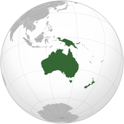
English: Orthographic map of Oceania. |
| ရက်စွဲ | |
| ရင်းမြစ် | Own work based on: Australia (orthographic projection).svg |
| စာရေးသူ | Ch1902 |
| SVG genesis | ဤ SVG ၏ ကုဒ်သည် ခိုင်လုံသည်။ SVG watermarked with invisible embedded text. |
.svg)
လိုင်စင်သတ်မှတ်ခြင်း
ကျွန်ုပ်၊ ဤလုပ်ဆောင်ချက်၏ မူပိုင်ခွင့်ပိုင်ရှင်အနေဖြင့် ဤနေရာမှ အောက်ပါလိုင်စင်များအောက်တွင် ထုတ်လွှင့်ပါသည်:
ဤဖိုင်ကို Creative Commons Attribution-Share Alike 3.0 Unported လိုင်စင်ဖြင့် သတ်မှတ်ထားသည်။
- သင်သည် လွတ်လပ်စွာ:
- မျှဝေရန် – ဖန်တီးမှုကို ကူးယူရန်၊ ဖြန့်ဖြူးရန်နှင့် ထုတ်လွှင့်ရန်
- ပြန်ရောနှောရန် – ဖန်တီးမှုကို ပြင်ဆင်ညှိနှိုင်းရန်
- အောက်ပါ အခြေအနေများတွင်:
- မှတ်ယူနိုင်ခြင်း – ပြောင်းလဲမှုများ ပြုလုပ်ခဲ့ပါက ဖန်တီးသူ သို့မဟုတ် လိုင်စင်ရှိသူမှ သတ်မှတ်သော အမျိုးအစားကို လိုက်နာရမည် (ဆိုလိုသည်မှာ သင့်အား သို့မဟုတ် သင့်ဖန်တီးမှုတွင် အသုံးပြုခြင်းအား ထောက်ခံချက်ပေးသည်ဟု မဆိုလိုပါ)။
- ထပ်တူမျှဝေ – ဤဖန်တီးမှုအား ပြင်ဆင်ခြင်း၊ ပြောင်းလဲခြင်း သို့မဟုတ် ထပ်ဆင့် ဖန်တီးခြင်း ပြုလုပ်ပါက ရရှိလာသော ဖန်တီးမှုကို ဤဖန်တီးမှုနှင့် သို့မဟုတ် ဆင်တူသော လိုင်စင်ဖြင့်သာ ဖြန့်ချိသင့်သည်။

|
ဤစာတမ်းကို GNU Free Documentation License, ဗားရှင်း ၁.၂ သို့မဟုတ် Free Software Foundation မှ ဖြန့်ချီထားသော မည်သည့်ယခင်ဗားရှင်းတစ်ခုခုအောက်တွင် Invariant Sections, Front-Cover Texts နှင့် Back-Cover Texts များမပါဝင်ဘဲ ကူးယူခြင်း၊ ဖြန့်ချီခြင်း နှင့်/သို့မဟုတ် ပြင်ဆင်ပြောင်းလဲနိုင်ရန် ခွင့်ပြုသည်။ လိုင်စင်မူပွားကို GNU Free Documentation License ခေါင်းစဉ်အောက်တွင် ထည့်သွင်းထားသည်။ |
သင်အလိုရှိရာ လိုင်စင်ကို ရွေးချယ်နိုင်ပါသည်။
ဖိုင်မှတ်တမ်း
ဖိုင်ကို ယင်းနေ့စွဲ အတိုင်း မြင်နိုင်ရန် နေ့စွဲ/အချိန် တစ်ခုခုပေါ်တွင် ကလစ်နှိပ်ပါ။
.svg&dir=prev)
.svg&offset=20221204003112)
.svg&offset=&limit=20)
.svg&offset=&limit=50)
.svg&offset=&limit=100)
.svg&offset=&limit=250)
.svg&offset=&limit=500)
| နေ့စွဲ/အချိန် | နမူနာပုံငယ် | မှတ်တမ်း ဒိုင်မန်းရှင်းများ | အသုံးပြုသူ | မှတ်ချက် | |
|---|---|---|---|---|---|
| ကာလပေါ် | ၁၈:၅၄၊ ၆ ဖေဖော်ဝါရီ ၂၀၂၃ | | ၅၄၁ × ၅၄၁ (၆၃ KB) | Golden Mage | A change to the map of Asia will first face debate from others. Hence, a change to the commonly accepted map of Oceania cannot be made without a wider consensus. |
| ၀၆:၃၃၊ ၆ ဖေဖော်ဝါရီ ၂၀၂၃ |  | ၅၄၁ × ၅၄၁ (၁၀၈ KB) | Kwamikagami | rv: then perhaps we need to change the Asia map to match. This is as defined in WP. | |
| ၁၈:၁၉၊ ၅ ဖေဖော်ဝါရီ ၂၀၂၃ |  | ၅၄၁ × ၅၄၁ (၆၃ KB) | Golden Mage | Reverted to the map that displays the more accepted definition of Oceania's boundaries. Widely accepted geopolitical definitions take precedence over mere geographical ones. The map of the Wikipedia page for Asia already includes the Maluku Islands. | |
| ၀၅:၀၁၊ ၅ ဖေဖော်ဝါရီ ၂၀၂၃ |  | ၅၄၁ × ၅၄၁ (၁၀၈ KB) | Treetoes023 | Reverted to version as of 06:27, 24 December 2022 (UTC) | |
| ၀၅:၀၀၊ ၅ ဖေဖော်ဝါရီ ၂၀၂၃ |  | ၅၄၁ × ၅၄၁ (၆၃ KB) | Treetoes023 | Reverted to version as of 13:25, 31 December 2022 (UTC) | |
| ၀၄:၅၅၊ ၅ ဖေဖော်ဝါရီ ၂၀၂၃ |  | ၅၄၁ × ၅၄၁ (၁၀၈ KB) | Treetoes023 | Reverted to version as of 00:31, 4 December 2022 (UTC) | |
| ၁၃:၂၅၊ ၃၁ ဒီဇင်ဘာ ၂၀၂၂ |  | ၅၄၁ × ၅၄၁ (၆၃ KB) | Golden Mage | Reverted to the map that displays the more accepted definition of Oceania's boundaries. Widely accepted geopolitical definitions take precedence over mere geographical ones. | |
| ၀၆:၂၇၊ ၂၄ ဒီဇင်ဘာ ၂၀၂၂ |  | ၅၄၁ × ၅၄၁ (၁၀၈ KB) | Kwamikagami | Reverted to version as of 00:31, 4 December 2022 (UTC) definition per WP-en | |
| ၀၆:၁၃၊ ၂၂ ဒီဇင်ဘာ ၂၀၂၂ |  | ၅၄၁ × ၅၄၁ (၆၃ KB) | Golden Mage | Reverted to the map that displays the more accepted definition of Oceania's boundaries. | |
| ၀၀:၃၁၊ ၄ ဒီဇင်ဘာ ၂၀၂၂ |  | ၅၄၁ × ၅၄၁ (၁၀၈ KB) | Kwamikagami | the Weber line divides Oceanic from Asian Wallacea |
ဖိုင်သုံးစွဲမှု
အောက်ပါ 20 စာမျက်နှာများ သည် ဤဖိုင်ကို အသုံးပြုထားသည်:
- တိုက်
- တောင်အမေရိက
- မြောက်အမေရိက
- ယူရေးရှား
- လက်တင်အမေရိက
- အန္တာတိက
- အမေရိက
- အာဖရိက
- အာဖရို-ယူရေးရှား
- အာရှ
- အိုရှန်းနီးယား
- အိုရှန်းနီးယားရှိ အချုပ်အခြာအာဏာပိုင်နိုင်ငံများနှင့် အမှီအခိုနယ်မြေများ စာရင်း
- ဥရောပ
- ဩစတြေးလျတိုက်
- တမ်းပလိတ်:Oceania-geo-stub
- တမ်းပလိတ်:တိုက်
- ကဏ္ဍ:တိုက်ကြီးများအလိုက် ကဏ္ဍများ
- မုခ်ဝ:ပထဝီဝင်
- မုခ်ဝ:ပထဝီဝင်/ဆောင်းပါးများ
- မုခ်ဝ:ပထဝီဝင်/မုခ်ဝခွဲများ
ဂလိုဘယ် ဖိုင်သုံးစွဲမှု
အောက်ပါ အခြားဝီကီများတွင် ဤဖိုင်ကို အသုံးပြုထားသည်-
- ab.wikipedia.org တွင် အသုံးပြုမှု
- ady.wikipedia.org တွင် အသုံးပြုမှု
- af.wikipedia.org တွင် အသုံးပြုမှု
- Afrika
- Asië
- Europa
- Kiribati
- Noord-Amerika
- Suid-Amerika
- Vanuatu
- Guam
- Nieu-Seeland
- Sjabloon:Kontinente
- Australië
- Nauru
- Wellington, Nieu-Seeland
- Hoofstad
- Lys van hoofstede
- Sjabloon:Lande van Oseanië
- Honolulu
- Antarktika
- Gondwana
- Eurasië
- Laurasië
- Kategorie:Lande in Oseanië
- Lys van lande
- Fidji
- Canberra
- Hawaii
- Lys van nasionale leuses
- Clipperton
- Oseanië
- Norfolkeiland
- Amerikas
- Tonga
- Tuvalu
- Sjabloon:Hoofstede in Oseanië
- Palau
- Australië (kontinent)
- Afrika-Eurasië
- Samoa
- Marshalleilande
- Salomonseilande
- Papoea-Nieu-Guinee
- Gefedereerde State van Mikronesië
- Nukuʻalofa
- Port Moresby
- Apia
- Funafuti
- Honiara
- Majuro
ဤဖိုင်ကို အခြားနေရာများတွင် အသုံးပြုထားမှုများအား ကြည့်ရှုရန်။
.svg)
.svg)