
ဖိုင်:Portugal location map.svg

Size of this PNG preview of this SVG file: ၃၁၃ × ၆၀၀ ပစ်ဇယ်. အခြား ပုံရိပ်ပြတ်သားမှု: ၁၂၅ × ၂၄၀ ပစ်ဇယ် | ၂၅၀ × ၄၈၀ ပစ်ဇယ် | ၄၀၀ × ၇၆၈ ပစ်ဇယ် | ၅၃၄ × ၁၀၂၄ ပစ်ဇယ် | ၁၀၆၈ × ၂၀၄၈ ပစ်ဇယ် | ၆၁၂ × ၁၁၇၃ ပစ်ဇယ်။
မူရင်းဖိုင် (SVG ဖိုင်, ၆၁၂ × ၁၁၇၃ pixels ကို အကြံပြုသည်, ဖိုင်အရွယ်အစား - ၂၁၁ KB)
| ဤဖိုင်သည် Wikimedia Commons မှဖြစ်ပြီး အခြားပရောဂျက်များတွင် သုံးကောင်းသုံးလိမ့်မည်။ ယင်း၏ ဖိုင်အကြောင်းစာမျက်နှာ တွင် ဖော်ပြထားချက်ကို အောက်တွင် ပြထားသည်။ Commons သည် မူပိုင်ခွင့်လွတ်လပ်သော မီဒီယာဖိုင်များ သိုလှောင်ထားရာ နေရာ ဖြစ်သည်။ သင်လည်း ပါဝင်ကူညီနိုင်ပါသည်။ |
အကျဉ်းချုပ်
| ဖော်ပြချက် |
Deutsch: Positionskarte von Portugal
Quadratische Plattkarte, N-S-Streckung 130 %. Geographische Begrenzung der Karte:
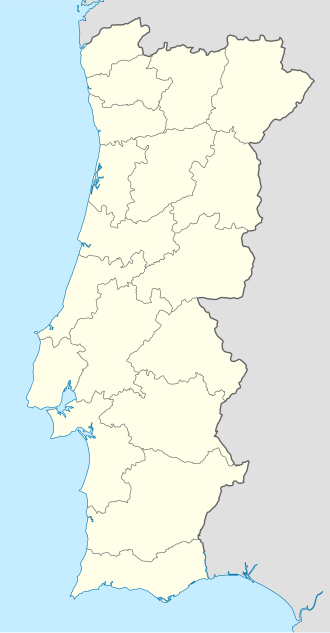
English: Location map of Portugal
Equirectangular projection, N/S stretching 130 %. Geographic limits of the map:
Español: Mapa de Portugal con los 18 distritos delimitados
Proyección cilíndrica equidistante, N/S alargamiento 130 %. Límites geográficos del mapa:
Português: Mapa de Portugal com os 18 distritos delimitados, para uso em localizações geográficas
Projecção cilíndrica equidistante, N/S alongamento 130 %. Limites geográficos do mapa:
|
| ရက်စွဲ | 03-07-2008 |
| ရင်းမြစ် | own work, using United States National Imagery and Mapping Agency data |
| စာရေးသူ | NordNordWest |
| အခြား ဗားရှင်းများ |
Derivative works of this file: |

|
This map has been made or improved in the German Kartenwerkstatt (Map Lab). You can propose maps to improve as well.
|
လိုင်စင်သတ်မှတ်ခြင်း
ကျွန်ုပ်၊ ဤလုပ်ဆောင်ချက်၏ မူပိုင်ခွင့်ပိုင်ရှင်အနေဖြင့် ဤနေရာမှ အောက်ပါလိုင်စင်များအောက်တွင် ထုတ်လွှင့်ပါသည်:

|
ဤစာတမ်းကို GNU Free Documentation License, ဗားရှင်း ၁.၂ သို့မဟုတ် Free Software Foundation မှ ဖြန့်ချီထားသော မည်သည့်ယခင်ဗားရှင်းတစ်ခုခုအောက်တွင် Invariant Sections, Front-Cover Texts နှင့် Back-Cover Texts များမပါဝင်ဘဲ ကူးယူခြင်း၊ ဖြန့်ချီခြင်း နှင့်/သို့မဟုတ် ပြင်ဆင်ပြောင်းလဲနိုင်ရန် ခွင့်ပြုသည်။ လိုင်စင်မူပွားကို GNU Free Documentation License ခေါင်းစဉ်အောက်တွင် ထည့်သွင်းထားသည်။ |
ဤဖိုင်ကို Creative Commons Attribution-Share Alike 3.0 Unported လိုင်စင်ဖြင့် သတ်မှတ်ထားသည်။
- သင်သည် လွတ်လပ်စွာ:
- မျှဝေရန် – ဖန်တီးမှုကို ကူးယူရန်၊ ဖြန့်ဖြူးရန်နှင့် ထုတ်လွှင့်ရန်
- ပြန်ရောနှောရန် – ဖန်တီးမှုကို ပြင်ဆင်ညှိနှိုင်းရန်
- အောက်ပါ အခြေအနေများတွင်:
- မှတ်ယူနိုင်ခြင်း – ပြောင်းလဲမှုများ ပြုလုပ်ခဲ့ပါက ဖန်တီးသူ သို့မဟုတ် လိုင်စင်ရှိသူမှ သတ်မှတ်သော အမျိုးအစားကို လိုက်နာရမည် (ဆိုလိုသည်မှာ သင့်အား သို့မဟုတ် သင့်ဖန်တီးမှုတွင် အသုံးပြုခြင်းအား ထောက်ခံချက်ပေးသည်ဟု မဆိုလိုပါ)။
- ထပ်တူမျှဝေ – ဤဖန်တီးမှုအား ပြင်ဆင်ခြင်း၊ ပြောင်းလဲခြင်း သို့မဟုတ် ထပ်ဆင့် ဖန်တီးခြင်း ပြုလုပ်ပါက ရရှိလာသော ဖန်တီးမှုကို ဤဖန်တီးမှုနှင့် သို့မဟုတ် ဆင်တူသော လိုင်စင်ဖြင့်သာ ဖြန့်ချိသင့်သည်။
သင်အလိုရှိရာ လိုင်စင်ကို ရွေးချယ်နိုင်ပါသည်။
ဖိုင်မှတ်တမ်း
ဖိုင်ကို ယင်းနေ့စွဲ အတိုင်း မြင်နိုင်ရန် နေ့စွဲ/အချိန် တစ်ခုခုပေါ်တွင် ကလစ်နှိပ်ပါ။
| နေ့စွဲ/အချိန် | နမူနာပုံငယ် | မှတ်တမ်း ဒိုင်မန်းရှင်းများ | အသုံးပြုသူ | မှတ်ချက် | |
|---|---|---|---|---|---|
| ကာလပေါ် | ၀၈:၂၇၊ ၂၉ ဩဂုတ် ၂၀၀၈ | | ၆၁၂ × ၁၁၇၃ (၂၁၁ KB) | NordNordWest | |
| ၁၈:၂၉၊ ၁၁ ဩဂုတ် ၂၀၀၈ |  | ၃၀၆ × ၅၈၆ (၂၀၇ KB) | NordNordWest | ||
| ၂၂:၀၁၊ ၂ ဇူလိုင် ၂၀၀၈ |  | ၃၀၆ × ၅၈၆ (၂၃၆ KB) | NordNordWest | {{Information |Description= {{de|Positionskarte von Portugal}} Quadratische Plattkarte, N-S-Streckung 130 %. Geographische Begrenzung der Karte: * N: 42.3° N * S: 36.7° N * W: 9.8° W * O: 6.0° W {{en|Location map of [[:en:Portugal|Por |
ဖိုင်သုံးစွဲမှု
အောက်ပါ 2 စာမျက်နှာများ သည် ဤဖိုင်ကို အသုံးပြုထားသည်:
ဂလိုဘယ် ဖိုင်သုံးစွဲမှု
အောက်ပါ အခြားဝီကီများတွင် ဤဖိုင်ကို အသုံးပြုထားသည်-
- af.wikipedia.org တွင် အသုံးပြုမှု
- als.wikipedia.org တွင် အသုံးပြုမှု
- am.wikipedia.org တွင် အသုံးပြုမှု
- an.wikipedia.org တွင် အသုံးပြုမှု
- Sacavém
- Lisbona
- Ericeira
- Mafra
- Sintra
- Braga
- Coimbra
- Évora
- Aveiro
- Guarda (Portugal)
- Leiria
- Setúbal
- Almada (Portugal)
- Miranda de l Douro
- Bumioso
- Sines
- Porto
- Estádio do Dragão
- Seu de Porto
- Cascais
- Guimarães
- Lousã
- Miranda do Corvo
- Pampilhosa da Serra
- Vila Nova de Gaia
- Pavilhão João Rocha
- Elvas
- Ponte de Sor
- Portalegre
- Plantilla:Mapa de localización Portugal
- ar.wikipedia.org တွင် အသုံးပြုမှု
- az.wikipedia.org တွင် အသုံးပြုမှု
ဤဖိုင်ကို အခြားနေရာများတွင် အသုံးပြုထားမှုများအား ကြည့်ရှုရန်။