
ဖိုင်:South Ayrshire UK location map.svg

Size of this PNG preview of this SVG file: ၄၆၃ × ၅၉၉ ပစ်ဇယ်. အခြား ပုံရိပ်ပြတ်သားမှု: ၁၈၅ × ၂၄၀ ပစ်ဇယ် | ၃၇၁ × ၄၈၀ ပစ်ဇယ် | ၅၉၄ × ၇၆၈ ပစ်ဇယ် | ၇၉၂ × ၁၀၂၄ ပစ်ဇယ် | ၁၅၈၃ × ၂၀၄၈ ပစ်ဇယ် | ၁၀၄၀ × ၁၃၄၅ ပစ်ဇယ်။
မူရင်းဖိုင် (SVG ဖိုင်, ၁၀၄၀ × ၁၃၄၅ pixels ကို အကြံပြုသည်, ဖိုင်အရွယ်အစား - ၁.၂၄ MB)
| ဤဖိုင်သည် Wikimedia Commons မှဖြစ်ပြီး အခြားပရောဂျက်များတွင် သုံးကောင်းသုံးလိမ့်မည်။ ယင်း၏ ဖိုင်အကြောင်းစာမျက်နှာ တွင် ဖော်ပြထားချက်ကို အောက်တွင် ပြထားသည်။ Commons သည် မူပိုင်ခွင့်လွတ်လပ်သော မီဒီယာဖိုင်များ သိုလှောင်ထားရာ နေရာ ဖြစ်သည်။ သင်လည်း ပါဝင်ကူညီနိုင်ပါသည်။ |
| ဖော်ပြချက် |
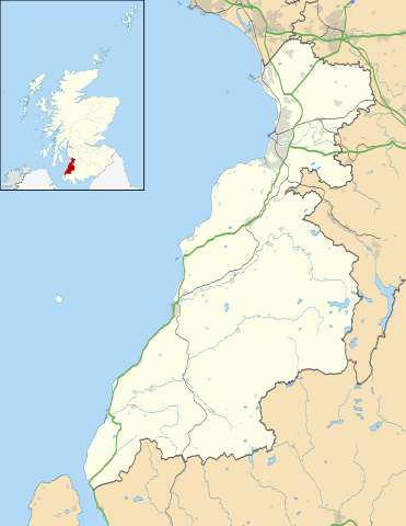
Blank map of South Ayrshire, UK with the following information shown:
Equirectangular map projection on WGS 84 datum, with N/S stretched 170% Geographic limits:
|
| ရက်စွဲ | |
| ရင်းမြစ် |
|
| စာရေးသူ | Nilfanion, created using Ordnance Survey data |
| ခွင့်ပြုချက် (ဤဖိုင်ကို ပြန်လည်အသုံးပြုခြင်း) |
ဤဖိုင်ကို Creative Commons Attribution-Share Alike 3.0 Unported လိုင်စင်ဖြင့် သတ်မှတ်ထားသည်။ မှတ်ယူနိုင်ခြင်း: Contains Ordnance Survey data © Crown copyright and database right
|
| အခြား ဗားရှင်းများ | File:South Ayrshire UK blank map.svg - Blank map |
ဖိုင်မှတ်တမ်း
ဖိုင်ကို ယင်းနေ့စွဲ အတိုင်း မြင်နိုင်ရန် နေ့စွဲ/အချိန် တစ်ခုခုပေါ်တွင် ကလစ်နှိပ်ပါ။
| နေ့စွဲ/အချိန် | နမူနာပုံငယ် | မှတ်တမ်း ဒိုင်မန်းရှင်းများ | အသုံးပြုသူ | မှတ်ချက် | |
|---|---|---|---|---|---|
| ကာလပေါ် | ၂၀:၂၄၊ ၂၆ စက်တင်ဘာ ၂၀၁၀ | | ၁၀၄၀ × ၁၃၄၅ (၁.၂၄ MB) | Nilfanion | {{Information |Description=Blank map of South Ayrshire, UK with the following information shown: *Administrative borders *Coastline, lakes and rivers *Roads and railways *Urban areas Equirectangular map projection on WGS 84 datum, wi |
ဖိုင်သုံးစွဲမှု
အောက်ပါ စာမျက်နှာ သည် ဤဖိုင်ကို အသုံးပြုထားသည်:
ဂလိုဘယ် ဖိုင်သုံးစွဲမှု
အောက်ပါ အခြားဝီကီများတွင် ဤဖိုင်ကို အသုံးပြုထားသည်-
- ar.wikipedia.org တွင် အသုံးပြုမှု
- bg.wikipedia.org တွင် အသုံးပြုမှု
- ceb.wikipedia.org တွင် အသုံးပြုမှု
- cy.wikipedia.org တွင် အသုံးပြုမှု
- de.wikipedia.org တွင် အသုံးပြုမှု
- en.wikipedia.org တွင် အသုံးပြုမှု
- List of monastic houses in Scotland
- South Ayrshire
- Ayr
- Glasgow Prestwick Airport
- Girvan
- Troon
- Alloway
- Prestwick
- Royal Troon Golf Club
- Maybole
- Alloway Auld Kirk
- RAF Prestwick
- Kirkmichael, South Ayrshire
- Straiton
- Barr, Ayrshire
- Annbank
- Blairquhan Castle
- Ballantrae
- Somerset Park
- RAF Heathfield
- Dundonald, South Ayrshire
- Seafield, Ayr
- Kincaidston
- Doonfoot
- Tarbolton
- Belmont, Ayr
- Dunure
- Colmonell
- Mossblown
- Burns Cottage
- Girvan Steeple
- University Hospital Ayr
- Old Dailly
- 2004 Open Championship
- Kirkoswald, South Ayrshire
- Barrhill, South Ayrshire
- Barassie
- RAF Dundonald
- Dailly
- 1997 Open Championship
- 1994 Open Championship
- 1989 Open Championship
- 1986 Open Championship
ဤဖိုင်ကို အခြားနေရာများတွင် အသုံးပြုထားမှုများအား ကြည့်ရှုရန်။