
ဖိုင်:Taiwan location map.svg

Size of this PNG preview of this SVG file: ၄၉၉ × ၆၀၀ ပစ်ဇယ်. အခြား ပုံရိပ်ပြတ်သားမှု: ၂၀၀ × ၂၄၀ ပစ်ဇယ် | ၃၉၉ × ၄၈၀ ပစ်ဇယ် | ၆၃၉ × ၇၆၈ ပစ်ဇယ် | ၈၅၂ × ၁၀၂၄ ပစ်ဇယ် | ၁၇၀၄ × ၂၀၄၈ ပစ်ဇယ် | ၁၀၁၆ × ၁၂၂၁ ပစ်ဇယ်။
မူရင်းဖိုင် (SVG ဖိုင်, ၁၀၁၆ × ၁၂၂၁ pixels ကို အကြံပြုသည်, ဖိုင်အရွယ်အစား - ၁၂၁ KB)
| ဤဖိုင်သည် Wikimedia Commons မှဖြစ်ပြီး အခြားပရောဂျက်များတွင် သုံးကောင်းသုံးလိမ့်မည်။ ယင်း၏ ဖိုင်အကြောင်းစာမျက်နှာ တွင် ဖော်ပြထားချက်ကို အောက်တွင် ပြထားသည်။ Commons သည် မူပိုင်ခွင့်လွတ်လပ်သော မီဒီယာဖိုင်များ သိုလှောင်ထားရာ နေရာ ဖြစ်သည်။ သင်လည်း ပါဝင်ကူညီနိုင်ပါသည်။ |

|
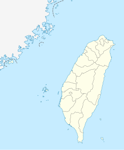
The boundaries on this map show the de facto situation. This is just one of several different views on the subject (see COM:NPOV). |
အကျဉ်းချုပ်
| ဖော်ပြချက် |
Quadratische Plattkarte, N-S-Streckung 110 %. Geographische Begrenzung der Karte:
Equirectangular projection, N/S stretching 110 %. Geographic limits of the map:
|
| ရက်စွဲ | |
| ရင်းမြစ် | own work, using United States National Imagery and Mapping Agency data |
| စာရေးသူ | NordNordWest |

|
This map has been made or improved in the German Kartenwerkstatt (Map Lab). You can propose maps to improve as well.
|
လိုင်စင်သတ်မှတ်ခြင်း
ကျွန်ုပ်၊ ဤလုပ်ဆောင်ချက်၏ မူပိုင်ခွင့်ပိုင်ရှင်အနေဖြင့် ဤနေရာမှ အောက်ပါလိုင်စင်များအောက်တွင် ထုတ်လွှင့်ပါသည်:

|
ဤစာတမ်းကို GNU Free Documentation License, ဗားရှင်း ၁.၂ သို့မဟုတ် Free Software Foundation မှ ဖြန့်ချီထားသော မည်သည့်ယခင်ဗားရှင်းတစ်ခုခုအောက်တွင် Invariant Sections, Front-Cover Texts နှင့် Back-Cover Texts များမပါဝင်ဘဲ ကူးယူခြင်း၊ ဖြန့်ချီခြင်း နှင့်/သို့မဟုတ် ပြင်ဆင်ပြောင်းလဲနိုင်ရန် ခွင့်ပြုသည်။ လိုင်စင်မူပွားကို GNU Free Documentation License ခေါင်းစဉ်အောက်တွင် ထည့်သွင်းထားသည်။ |
ဤဖိုင်ကို Creative Commons Attribution-Share Alike 3.0 Unported လိုင်စင်ဖြင့် သတ်မှတ်ထားသည်။
- သင်သည် လွတ်လပ်စွာ:
- မျှဝေရန် – ဖန်တီးမှုကို ကူးယူရန်၊ ဖြန့်ဖြူးရန်နှင့် ထုတ်လွှင့်ရန်
- ပြန်ရောနှောရန် – ဖန်တီးမှုကို ပြင်ဆင်ညှိနှိုင်းရန်
- အောက်ပါ အခြေအနေများတွင်:
- မှတ်ယူနိုင်ခြင်း – ပြောင်းလဲမှုများ ပြုလုပ်ခဲ့ပါက ဖန်တီးသူ သို့မဟုတ် လိုင်စင်ရှိသူမှ သတ်မှတ်သော အမျိုးအစားကို လိုက်နာရမည် (ဆိုလိုသည်မှာ သင့်အား သို့မဟုတ် သင့်ဖန်တီးမှုတွင် အသုံးပြုခြင်းအား ထောက်ခံချက်ပေးသည်ဟု မဆိုလိုပါ)။
- ထပ်တူမျှဝေ – ဤဖန်တီးမှုအား ပြင်ဆင်ခြင်း၊ ပြောင်းလဲခြင်း သို့မဟုတ် ထပ်ဆင့် ဖန်တီးခြင်း ပြုလုပ်ပါက ရရှိလာသော ဖန်တီးမှုကို ဤဖန်တီးမှုနှင့် သို့မဟုတ် ဆင်တူသော လိုင်စင်ဖြင့်သာ ဖြန့်ချိသင့်သည်။
သင်အလိုရှိရာ လိုင်စင်ကို ရွေးချယ်နိုင်ပါသည်။
ဖိုင်မှတ်တမ်း
ဖိုင်ကို ယင်းနေ့စွဲ အတိုင်း မြင်နိုင်ရန် နေ့စွဲ/အချိန် တစ်ခုခုပေါ်တွင် ကလစ်နှိပ်ပါ။
| နေ့စွဲ/အချိန် | နမူနာပုံငယ် | မှတ်တမ်း ဒိုင်မန်းရှင်းများ | အသုံးပြုသူ | မှတ်ချက် | |
|---|---|---|---|---|---|
| ကာလပေါ် | ၁၁:၁၅၊ ၂၂ ဩဂုတ် ၂၀၁၁ | | ၁၀၁၆ × ၁၂၂၁ (၁၂၁ KB) | NordNordWest | minor corrections |
| ၁၁:၅၄၊ ၁၉ ဇူလိုင် ၂၀၁၁ |  | ၁၀၁၆ × ၁၂၂၂ (၁၆၆ KB) | Bencmq | Reverted to the version before dispute | |
| ၀၉:၄၆၊ ၁၉ ဇူလိုင် ၂၀၁၁ |  | ၁၀၁၆ × ၁၂၂၂ (၁၅၆ KB) | JOSH tw | You did not answer my query. If you would like to use this file on global website of wiki commons, you have to consider different concepts in order to keep it neutral | |
| ၀၇:၂၄၊ ၁၉ ဇူလိုင် ၂၀၁၁ |  | ၁၀၁၆ × ၁၂၂၁ (၁၂၁ KB) | NordNordWest | You can upload a new file if you want to, but don't change the status that is shown here. Next revert -> COM:V | |
| ၀၄:၂၀၊ ၁၉ ဇူလိုင် ၂၀၁၁ |  | ၁၀၁၆ × ၁၂၂၂ (၁၅၆ KB) | JOSH tw | If Kosovo as an UN unreconignized state can be shown on distinct appearance with Serbia, there is unreasonable to treat each other differently... especially P.R.China has never ruled Taiwan at any period of history | |
| ၂၁:၅၉၊ ၁၈ ဇူလိုင် ၂၀၁၁ |  | ၁၀၁၆ × ၁၂၂၁ (၁၂၁ KB) | NordNordWest | please don't change the political status shown in this map | |
| ၂၀:၂၃၊ ၁၈ ဇူလိုင် ၂၀၁၁ |  | ၁၀၁၆ × ၁၂၂၂ (၁၅၆ KB) | JOSH tw | Fixed map, political divisions have changed | |
| ၁၆:၅၄၊ ၃ ဇွန် ၂၀၁၁ |  | ၁၀၁၆ × ၁၂၂၁ (၁၂၇ KB) | NordNordWest | please don't change the political status shown in this map | |
| ၁၃:၁၉၊ ၃ ဇွန် ၂၀၁၁ |  | ၁၀၁၆ × ၁၂၂၂ (၁၅၆ KB) | Energiya | Fix the border of Matsu(Dongyin) and Kinmen (Dadan, Erdan, Wuqiu) see the page of Matsu Island and Kinmen. | |
| ၁၇:၁၉၊ ၂၈ ဒီဇင်ဘာ ၂၀၁၀ |  | ၁၀၁၆ × ၁၂၂၂ (၁၆၆ KB) | NordNordWest | wrong upd |
ဖိုင်သုံးစွဲမှု
အောက်ပါ 2 စာမျက်နှာများ သည် ဤဖိုင်ကို အသုံးပြုထားသည်:
ဂလိုဘယ် ဖိုင်သုံးစွဲမှု
အောက်ပါ အခြားဝီကီများတွင် ဤဖိုင်ကို အသုံးပြုထားသည်-
- af.wikipedia.org တွင် အသုံးပြုမှု
- an.wikipedia.org တွင် အသုံးပြုမှု
- ar.wikipedia.org တွင် အသုံးပြုမှု
- ast.wikipedia.org တွင် အသုံးပြုမှု
- Taiwán
- Taipei 101
- Taipéi
- Nuevu Taipéi
- Keelung
- Taoyuan
- Taichung
- Muséu Nacional del Palaciu
- Islles Pescadores
- Módulu:Mapa de llocalización/datos/República de China
- Módulu:Mapa de llocalización/datos/Taiwán
- Módulu:Mapa de llocalización/datos/República de China/usu
- Módulu:Mapa de llocalización/datos/Taiwán/usu
- Aeropuertu Internacional de Taiwán Taoyuan
- Puertu de Kaohsiung
- Puertu de Taipéi
- az.wikipedia.org တွင် အသုံးပြုမှု
- ba.wikipedia.org တွင် အသုံးပြုမှု
- bcl.wikipedia.org တွင် အသုံးပြုမှု
- be.wikipedia.org တွင် အသုံးပြုမှု
- bg.wikipedia.org တွင် အသုံးပြုမှု
- bn.wikipedia.org တွင် အသုံးပြုမှု
- bs.wikipedia.org တွင် အသုံးပြုမှု
- ceb.wikipedia.org တွင် အသုံးပြုမှု
ဤဖိုင်ကို အခြားနေရာများတွင် အသုံးပြုထားမှုများအား ကြည့်ရှုရန်။