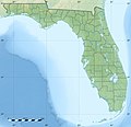
ဖိုင်:USA Florida relief location map.jpg
ပုံပန်းသွင်ပြင်

ဤနမူနာ၏ အရွယ်အစား - ၆၁၉ × ၅၉၉ ပစ်ဇယ်။ အခြား ပုံရိပ်ပြတ်သားမှု: ၂၄၈ × ၂၄၀ ပစ်ဇယ် | ၄၉၆ × ၄၈၀ ပစ်ဇယ် | ၇၉၃ × ၇၆၈ ပစ်ဇယ် | ၁၁၃၂ × ၁၀၉၆ ပစ်ဇယ်။
မူရင်းဖိုင် (၁၁၃၂ × ၁၀၉၆ pixels, ဖိုင်အရွယ်အစား - ၂၁၃ KB, MIME အမျိုးအစား image/jpeg)
ဖိုင်မှတ်တမ်း
ဖိုင်ကို ယင်းနေ့စွဲ အတိုင်း မြင်နိုင်ရန် နေ့စွဲ/အချိန် တစ်ခုခုပေါ်တွင် ကလစ်နှိပ်ပါ။
| နေ့စွဲ/အချိန် | နမူနာပုံငယ် | မှတ်တမ်း ဒိုင်မန်းရှင်းများ | အသုံးပြုသူ | မှတ်ချက် | |
|---|---|---|---|---|---|
| ကာလပေါ် | ၁၂:၁၂၊ ၁၉ ဇူလိုင် ၂၀၁၀ |  | ၁၁၃၂ × ၁၀၉၆ (၂၁၃ KB) | Sting | Color profile |
| ၁၉:၅၆၊ ၁၅ ဒီဇင်ဘာ ၂၀၀၈ |  | ၁၁၃၂ × ၁၀၉၆ (၁၈၀ KB) | Sting | == Summary == {{Location|27|45|00|N|83|49|30|W|scale:4000000}} <br/> {{Information |Description={{en|Blank physical map of the State of Florida, USA, for geo-location purpose, with counties boundaries.}} {{fr|Carte ph |
ဖိုင်သုံးစွဲမှု
အောက်ပါ 2 စာမျက်နှာများ သည် ဤဖိုင်ကို အသုံးပြုထားသည်:
ဂလိုဘယ် ဖိုင်သုံးစွဲမှု
အောက်ပါ အခြားဝီကီများတွင် ဤဖိုင်ကို အသုံးပြုထားသည်-
- ar.wikipedia.org တွင် အသုံးပြုမှု
- ast.wikipedia.org တွင် အသုံးပြုမှု
- azb.wikipedia.org တွင် အသုံးပြုမှု
- az.wikipedia.org တွင် အသုံးပြုမှု
- ban.wikipedia.org တွင် အသုံးပြုမှု
- be.wikipedia.org တွင် အသုံးပြုမှု
- bg.wikipedia.org တွင် အသုံးပြုမှု
- Маями
- Тампа
- Джаксънвил
- Орландо
- Мирамар (Флорида)
- Дестин
- Холивуд (Флорида)
- Талахаси (Флорида)
- Мелбърн (Флорида)
- Сейнт Питърсбърг
- Нейпълс
- Индиан Рокс Бийч
- Клиъруотър (Флорида)
- Гейнсвил
- Санфорд
- Форт Лодърдейл
- Маями Бийч
- Дейтона Бийч
- Ларго (Флорида)
- Хаялия
- Окичоби
- Коко Бийч
- Сарасота
- Кейп Коръл
- Пемброук Пайнс
- Пенсакола
- Шаблон:ПК САЩ Флорида
- Бока Ратон
- Уинтър Парк
- Апалачи (залив)
- Индиън Ривър (Флорида)
- Лодърхил
- Палм Бийч
- Никелодеон Студиос
- Флорида (полуостров)
- Флорида Кийс
- bn.wikipedia.org တွင် အသုံးပြုမှု
ဤဖိုင်ကို အခြားနေရာများတွင် အသုံးပြုထားမှုများအား ကြည့်ရှုရန်။


